Geoinformatics research
Geo-informatics Research
|
|
|
|
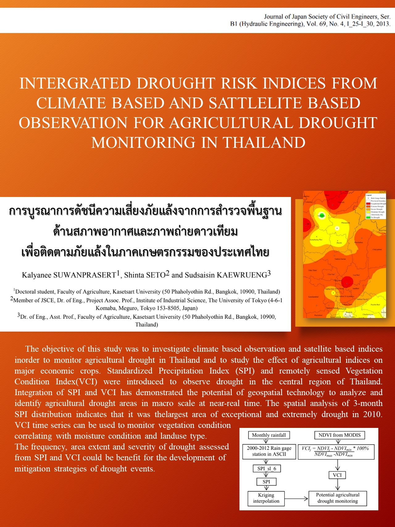
content This study investigates the use of climate observations and satellite indices to monitor agricultural drought in Thailand and to examine the impact of agricultural indices on major cash crops. The Standardized Precipitation Index (SPI) and the Remotely Senseed Vegetation Condition Index (VCI) were used to observe drought conditions in central Thailand. The integration of SPI and VCI demonstrated the potential of geospatial technology to analyze and identify agricultural drought areas at a macro level in near real-time. Spatial analysis of the SPI distribution over a three-month period identified the areas with the most severe drought in 2010. VCI timelines can be used to track vegetation conditions in relation to moisture levels and land use type. The frequency, extent, and severity of drought, as estimated by SPI and VCI, may be useful for developing drought mitigation strategies. |
|
|
Researcher Ms. Kalyanee Suwanprasert, Senior Policy and Planning Analyst. Department of Water Resources The University of Tokyo (4-6-1 Komaba, Meguro, Tokyo 153-8505, Japan) 2013 |
|
|
Download: |